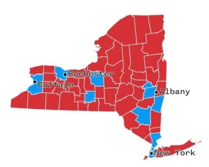
This is what a Blue State post-election ‘by county' breakdown map looks like, after the Blue guys beat the Red guys in the election. Really. 😑
Best part about it? It's dual-purpose.
You can tuck it away, right in the “Strategic & Tactical Planning Resources: CW2" files, for handy access later on when it's needed.
Those are some juicy looking containable and exploitable perimeters right there. 😉


Red is where they work for a living, blue is government assistance handouts go figure.
Unreal